- Aanbieding!
- -€ 25,00



C-Map kaart gebied naar keuze MAX-N+ Wide
C-Map kaart gebied naar keuze MAX-N+ Wide
C Map MAX N+ technologie is ontwikkeld voor de nieuwste plotters van Lowrance, B&G en Simrad.
De kaarten zijn enkel beschikbaar Micro-SD en worden geleverd met adapter naar SD.
FULL-FEATURED VECTOR CHARTS
HARBOR DETAILS
HARBOR APPROACH DETAILS
DETAILED MARINA PORT PLANS
Satalliet fotografie
Custom Shaded depths
Fishing data
Dynamic Tides and currents
Easy Routing
Tidal heights
Tidal flows
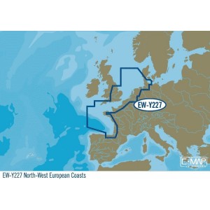
| EW-Y227 : North-West European Coasts, MAX-N+: Wide met o.a. - NEDERLAND - BELGIE - FRANKRIJK - ENGELAND - DENEMARKEN >>> C-Map kaart gebied naar keuze vermeld het kaart nummer bij uw bestelling <<< EN-Y299 : Baltic Sea and Denmark, MAX-N+: Wide |
| RS-Y202 : Russian Federation North West, MAX-N+: Wide |
| EM-Y076 : South-West European Coasts, MAX-N+: Wide |
| EW-Y227 : North-West European Coasts, MAX-N+: Wide |
| EW-Y226 : Uk Ireland and The Channel, MAX-N+: Wide |
| EN-Y326 : Finland Lakes, MAX-N+: Wide |
| EW-Y228 : West European Coasts, MAX-N+: Wide |
| EN-Y300 : North Sea and Denmark, MAX-N+: Wide |
| EN-Y080 : Germany Inland, MAX-N+: Wide |
| EM-Y111 : East Mediterranean Black Caspian Seas, MAX-N+: Wide |
| EN-Y590 : Scandinavia Inland Waters, MAX-N+: Wide |
| EN-Y068 : Central European Lakes, MAX-N+: Wide |
| EW-Y225 : France Inland, MAX-N+: Wide |
| EN-Y076 : Belgium Inland and River Rhein, MAX-N+: Wide |
| EN-Y604 : Russian Lakes, MAX-N+: Wide |
| EN-Y084 : Dniepr River, MAX-N+: Wide |
| RS-Y210 : Volga- Cheboksary-Volgograd, MAX-N+: Wide |
| RS-Y216 : Volga- Kama River, MAX-N+: Wide |
| EN-Y082 : Danube- Kelheim to Black Sea, MAX-N+: Wide |
| RS-Y212 : Tver- Rybinsk, MAX-N+: Wide |
| ME-Y204 : Red Sea to The Gulf and Seychelles Is, MAX-N+: Wide |
| RS-Y214 : Rybinsk-Cheboksary, MAX-N+: Wide |
ALLEEN LEVERBAAR ALS SD / MICRO SD